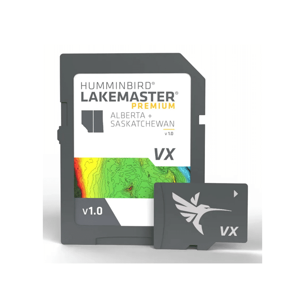


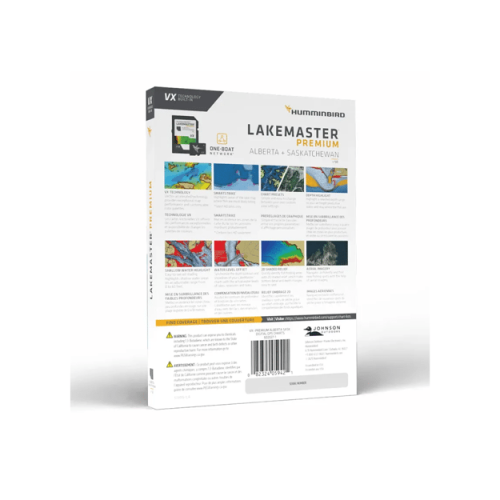


Humminbird LakeMaster VX Premium Charts
$279.99
Explore the lakes and waterways with Humminbird LakeMaster Premium charts with 2D shaded relief and aerial imagery.
In stock
Humminbird® LakeMaster® Maps deliver unrivaled detail, accuracy and innovative, one-of-a-kind features you need to eliminate unproductive water and find the best fishing spots faster. Explore the lakes and waterways with Humminbird LakeMaster Premium Alberta and Saskatchewan v 1.0 with 2D shaded relief and aerial imagery.
Humminbird LakeMaster Premium Features:
- Compatible with Humminbird HELIX® G3/G3N units, all SOLIX® units, all APEX™ units and all XPLORE™ units.
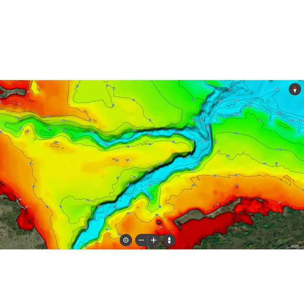
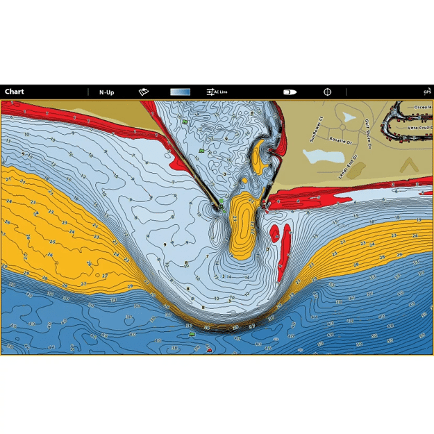
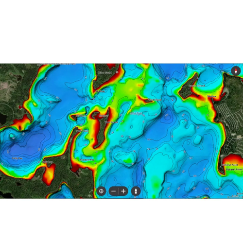
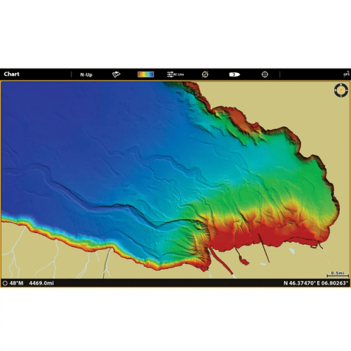
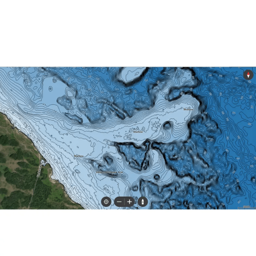
- 2D Shaded Relief: Make bottom detail and depth changes easy to spot so you can quickly identify fish holding areas.
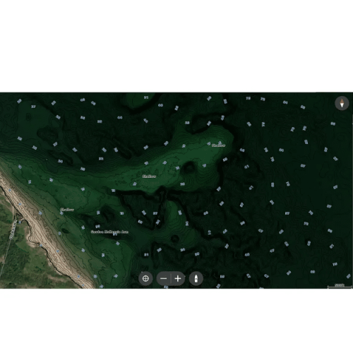
- Aerial Imagery: Navigate more confidently and find new fishing spots with the help of aerial imagery.
- VX Technology: Provides exceptional map performance and customizable color palettes.
- SmartStrike: Highlights areas of the lake map where fish are most likely biting. *Select HD Lakes Only
- Chart Presets: Simple and easy to change between your own custom view settings.
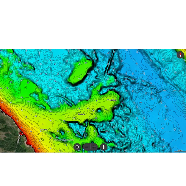
- Depth Highlight: Highlight a selected depth range so you can target productive water and stay where the fish are.
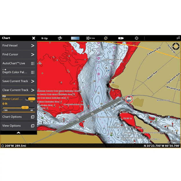
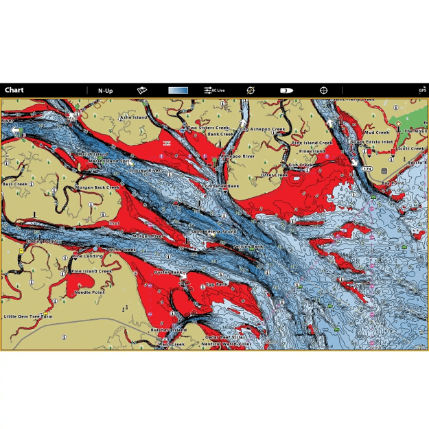
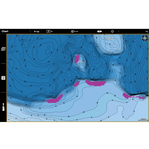
- Shallow Water Highlight: Easy-to-see red shading highlights shallow water areas on an adjustable range from 0 to 60 feet.
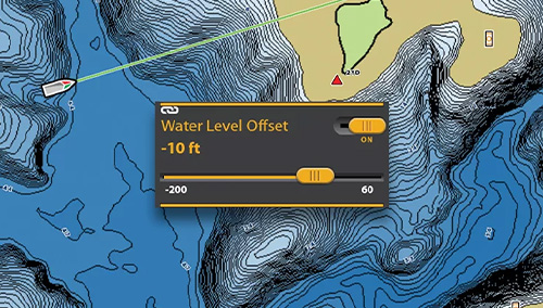
- Water Level Offset: Synchronize the depth contours and shorelines of your LakeMaster charts with the actual water levels of lakes, reservoirs and rivers.
- One-Boat Network®: Connect your Humminbird LakeMaster® chart and Minn Kota® trolling motor, allowing your boat to automatically follow a depth contour line.
- 1-Year Cartography Warranty. Opened packages are not eligible for return.
- HELIX 9-15 (G3N and newer) & All SOLIX require v1.031 Basemap
- HELIX 5/7/8 (G3/G3N and newer) require v2.010 Basemap
 |
 |
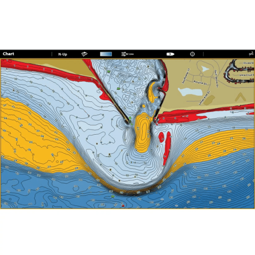
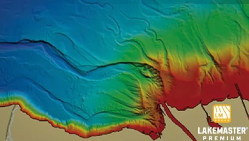
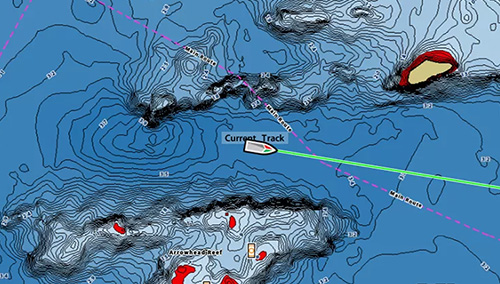
SPOT ACTIVE FISH AREAS FAST2D shaded relief reveals bottom detail and depth changes at a glance—so you can find productive zones quickly. |
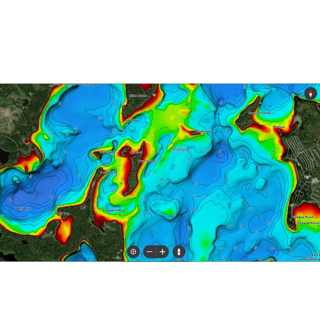
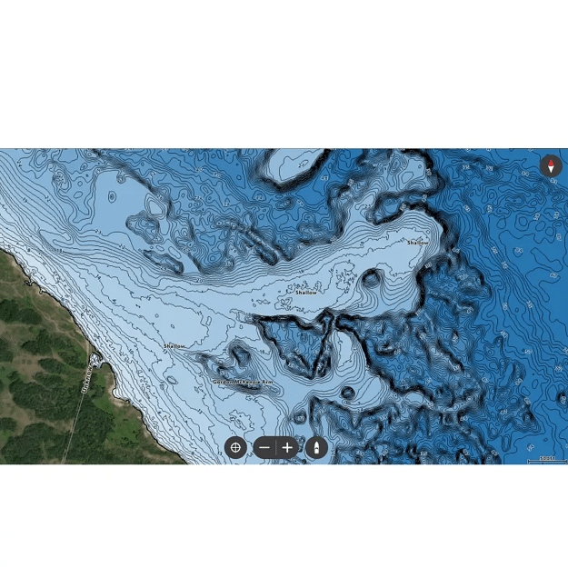
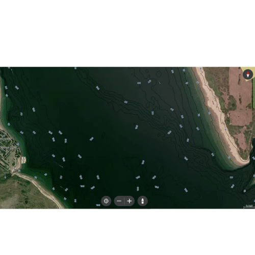
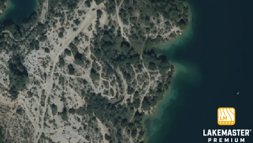
BROWSE FOR NEW SPOTS WITH CONFIDENCEAerial imagery layers help you navigate with precision and identify new fishing areas before you even hit the water. |
 |
 |
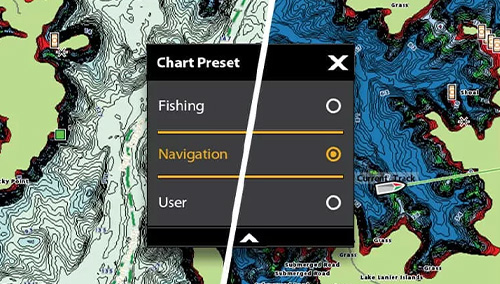
SWITCH VIEWS IN SECONDSSet up and toggle between three custom chart presets, keeping your most-used views just a tap away. |
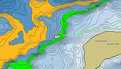
LOCK IN ON PRIME DEPTH ZONESHighlight up to four custom depth ranges to zero in on the water where fish are most active. |
 |
 |
STAY SAFE AND FIND HOTSPOTSRed shading clearly marks shallow water—adjustable from 0 to 60 feet—so you can avoid hazards and target fish-holding shallows. |
ADJUSTABLE WATER LEVEL OFFSETSynchronize the depth contours and shorelines of your charts with the actual water levels, so that your chart will reflect the correct water level. |
| Brand | Humminbird |
|---|---|
| Region | Alberta & Saskatchewan, Manitoba, Ontario, Quebec, Great Lakes |