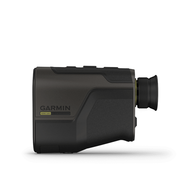
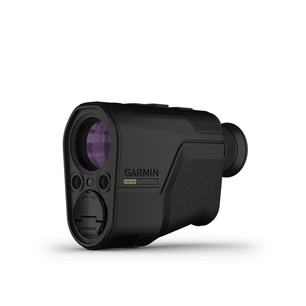

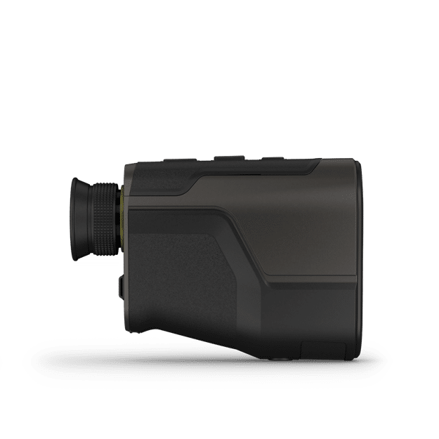


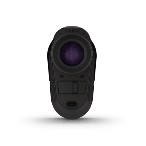

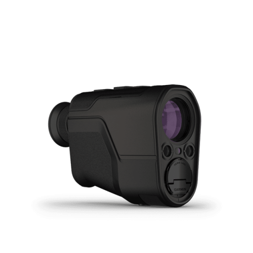
Garmin Xero L60i Laser Rangefinder
$3,499.99
Use coupon code: FREESHIP and enjoy FREE Ground shipping via UPS Standard within Canada!
Limited time offer. Bulk orders are subject to shipping charges.
Out of Stock (On Order)
Get notified when this product is back in stock
- Description
- Additional information
- Video
- Specifications
- Package Includes
- Product Guides & Documentation
- Accessories
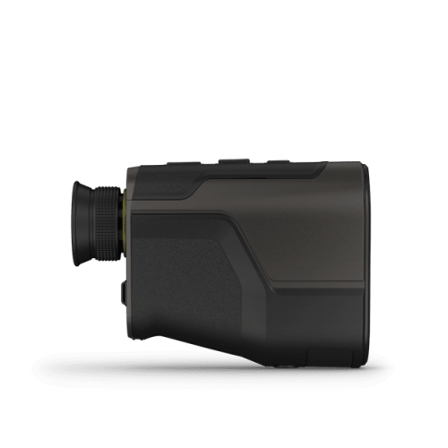
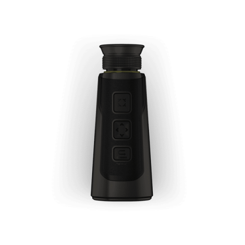
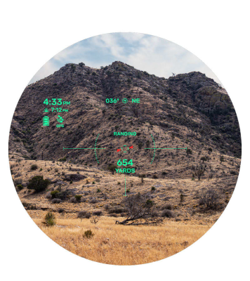
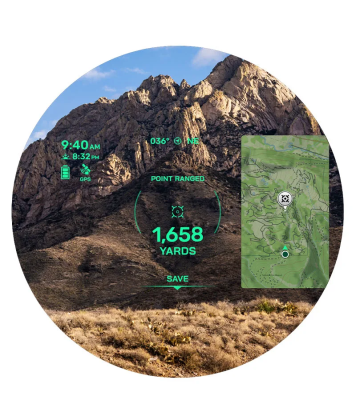
Know the distance and beyond with the Xero L60i laser rangefinder. This high-performance rangefinder combines premium optics with advanced GPS technology and state-of-the-art sensors for an unmatched range-finding experience. Get a sharp view through a full-color, high-resolution graphic overlay that displays distance, mapping, navigation and more. Range trees out to 2,000 yards, and range animals out to 1,500 yards with 7X magnification. Don’t just know the distance — know the precise location with advanced navigation features. Drop a waypoint on locations you’ve ranged to keep track of them, or share the locations with your compatible device. Use the graphic overlay with onboard TopoActive mapping to navigate to projected waypoints with the Laser Locate™ feature. For locations beyond rangeable distances, use the sensor locate feature to drop a waypoint. If you lose sight of the ranged location while traveling to it, visual recall and the mapping overlay on the display can guide you back to it.
Features of Xero L60i Laser Rangefinder
 |
VERSATILE RANGEUse the 7X magnification to range trees out to 2,000 yards and animals out to 1,500 yards. In optimal low-light conditions, reach all the way out to 7,500 yards to retro reflective objects. Get pinpoint accuracy and precision with proprietary precision lock technology. Learn more. |
 |
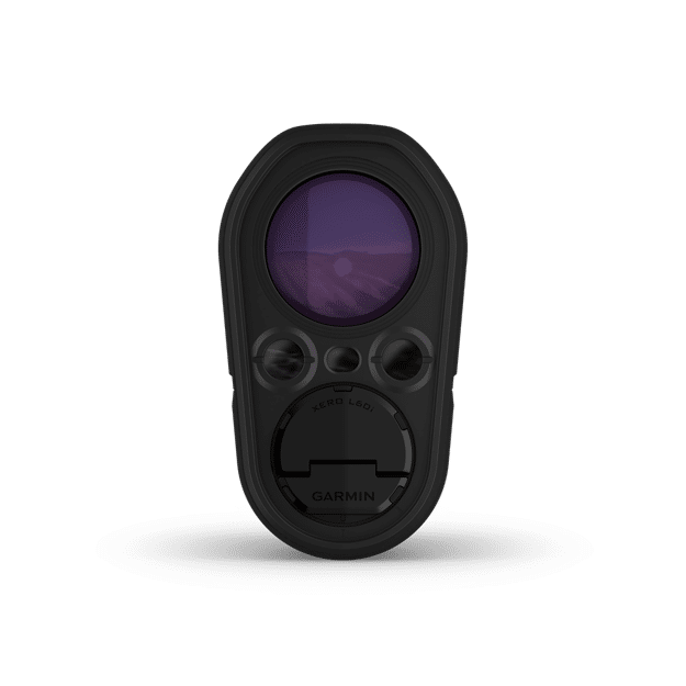
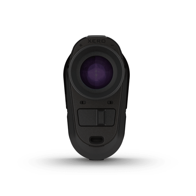
GRAPHIC OVERLAYGet a sharp view through a full-color, high-resolution graphic overlay that displays distance, location, mapping, ballistics, navigation and more. Learn more. |
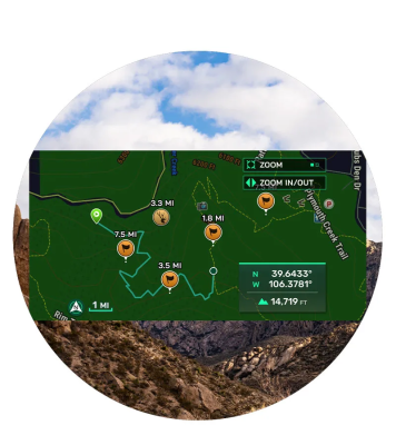 |
NAVIGATION FEATURESLook through the device, and let the augmented reality guide you to waypoints you’ve dropped with onboard TopoActive mapping. Keep your bearings with a 3-axis compass, and see elevation profiles of your route. You can even see an overhead perspective of your location on the graphic display overlay. |
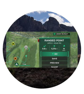 |
ADVANCED WAYPOINTSLeverage advanced GPS technology and onboard sensors to drop a waypoint on objects you’ve ranged with the Laser Locate™ waypoint projection feature. Project a waypoint beyond rangeable distances with the sensor locate feature. If you lose sight of an object while traveling to it, visual recall on the graphic overlay will guide you back to it. Learn more. |
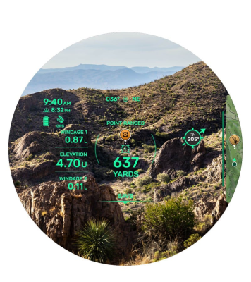 |
ONBOARD BALLISTICSAccess the onboard Applied Ballistics Ultralight™ solver with the AB Quantum app, and get the data you need to make the perfect shot. Archers also get arrow ballistics, such as max arrow height, angle-compensated range and more. |
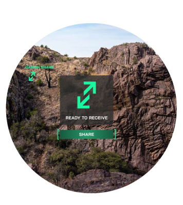 |
NAVIGATION ECOSYSTEMSend waypoints or data to your compatible smartphone, and then share it with your compatible Garmin device so you can close the distance with other Garmin devices as well. Spot something but your partner can’t find it? This feature also lets you share waypoints with your partner’s compatible devices. Learn more. |
| Weight | 1.8 lbs |
|---|---|
| Dimensions | 5 × 8.2 × 3.6 in |
| Brand | Garmin |
Video
Specifications
Garmin Xero L60i Specs
General |
|
| Dimension | 4.94″ x 3.53″ x 1.99″ (125.41 mm x 89.66 mm x 50.59 mm) |
|---|---|
| Weight | No battery: 0.80 lbs (362.88 g) With battery: 0.849 lbs (385.1 g) |
| Water rating | IPX7 |
| Display Type | DLP augmented reality |
| Display Size | Overlaid on visual scene |
| Display Resolution | 960 x 540 pixels |
| Battery type | 2 AAA lithium batteries (included) |
| Battery life | 1,400 ranges (1 sec range, 10 sec display) |
| Multi-color display | ✔ |
| Operating range | -20° C to 60° C (-4° F to 140° F) |
| Memory/History | 32 GB internal less file system space |
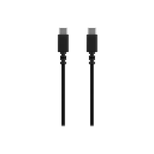
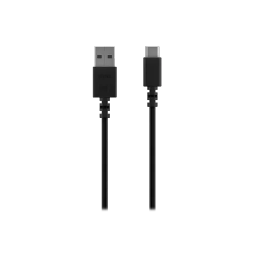
| Interface | USB-C |
| Laser classification | Class 1 |
Daily Smart Features |
|
| Connectivity | Bluetooth® |
| Mobile app | Explore App |
Xero Laser Range Finder Features |
|
| Magnification | 7x |
| Objective | 32 mm |
| Field of view | 7 degrees |
| Field of View (linear feet at 1,000 yards) | 365 ft |
| Eye relief | 0.71″ (18 mm) |
| Exit pupil diameter | 4.6 mm |
| Focus adjustment | +/- 4 diopters |
| Compass | ✔ |
| Barometer | ✔ |
| Precision | +/- .1 m |
| Accuracy | +/- .25 m out to 1,000 m +/- 1.0 m beyond 1,000 m |
| Distance to targets (full sun) | Animals: 1,375 m (1,500 yds); Trees: 1,800 m (2,000 yds); Retro reflective: 5,000 m (5,500 yds) |
| Distance to targets (optimal conditions) | Animals: 2,775 m (3,000 yds); Trees: 3,600 m (4,000 yds); Retro reflective: 7,000 m (7,500 yds) |
| Laser Locate | ✔ |
| Sensor Locate | ✔ |
| Onboard mapping | ✔ |
| Visual recall | ✔ |
| Applied Ballistics Solver | Ultralight, access via AB Quantum app |
| Archery ballistics | ✔ |
| Angle compensated distance | ✔ |
| Garmin share | ✔ |
| Stores locations, tracks and courses | ✔ |
| Measures distances between 2 points | ✔ |
| Area calculation | ✔ |
| Compatible with Garmin Explore App | ✔ |
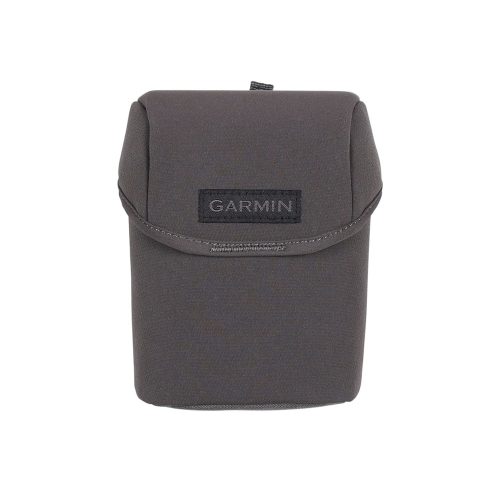
| Carrying case | yes (included) |
| Laser beam divergence | 0.5 x 0.5 mrad |
Package Includes
In the Box:
- Xero® L60i laser rangefinder
- Carrying case
- 2 AAA lithium batteries
- Power/data cable
- Documentation
Product Guides & Documentation
Accessories
Optional Accessories …
Optional Accessories …